
Cost-share
The UMRWP was recently awarded funds from the Indiana State Department of Agriculture’s Clean Water Indiana program for soil conservation practices. Other cost-share grants the group has received were awarded by the Ball Brothers Foundation and the IDNR’s LARE program; these two grants will fund cover crops. Cost-share funds will be available sometime in 2017. Applications are now available at each county’s SWCD. The application deadline is March 21, so don’t delay! The UMRWP will continue to seek additional grant funding in the future. Currently, an application for a 319 grant is pending. Funding from a 319 grant would not only fund additional cost-share BMPs, but would also allow the UMRWP to hold educational events in the future.
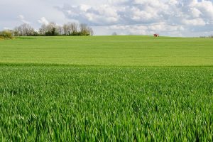
Cover Crops
Logjam Removal
Stream Bank Stabilization
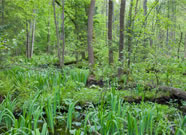
Forest Conservation
- Streambank Stabilization
- Engineering Feasibility Studies
- Logjam Removal
- Covercrops
- Forest Conservation
- Canoe Launch
IDNR LARE Grant will fund streambank stabilization along Deer Creek in Grant County
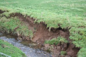
Streambank erosion on Deer Creek is threatening to destroy several yards of the Cardinal Greenway in Grant County. An IDNR LARE grant was awarded to stabilize the streambank using the Rosgen Stream Classification System and vegetative practices. The Cardinal Greenway agrees to maintain the site for at least 5 years.
The UMRWP identified this cost-share opportunity in 2013 and assisted the Cardinal Greenway in developing the initial LARE grant application. The engineering grant was awarded and a design was developed to solve the erosion problem. In 2014, the Cardinal Greenway subsequently applied for implementation funds and was awarded an $80,000 bank stabilization grant earlier this year. The stabilized reach will protect the Cardinal Greenway trail as well as reduce sediment contribution to the subwatershed. The project is projected to be started and completed in 2017.
As part of the Rosgen Stream Classification System method, a survey and pebble count was conducted. Based upon that information, it was determined that the stream was a G6 in the Rosgen Classification system, with a sinuosity of >1.2, an entrenchment ratio of <1.4, a width to depth ratio of <12, and a slope of .02-.039. Using the regional curve for Ohio and the drainage area (.001 square miles), it was determined that the stream should be a B5 type stream. This type has a sinuosity of >1.2, an entrenchment ratio of 1.4-2.2, a width to depth ratio of >12, and a slope of .02-.039. Despite the slope for both classes being the same range, the stream’s slope changed from 0.03 to 0.028. Using this information, the stream was redesigned to meet these criteria. Live stakes, brush layering, coir logs, erosion fabric, and native herbaceous vegetation will strengthen the channel, reducing the extremity and effects of future erosion.
Walnut Creek Feasibility Study
In 2016, the UMRWP was awarded funding to conduct an engineering feasibility study of Walnut Creek. The study will assess the whole length of the stream and identify and prioritize areas needing stabilization. Guidance will be offered to landowners on how to address erosion sites using Natural Channel Design or other methods.
Walnut Creek was identified by the UMRWP as having high amounts of streambank erosion. Based on water quality data collected by the UMRWP, Walnut Creek had the highest exceedances of sediment loading in the six county region during both high and low flow events. As a tributary channel, it had the highest rate of concern expressed through our public survey (combination of public meeting and comment card). Concerns specifically noted sediment erosion, logjam presence, and general maintenance neglect. Walnut Creek is also challenged by the fact much of the drainage area is in a glacial moraine (unconsolidated surface materials and bedrock) which is contributing to instability. Walnut Creek tributary is unique in that it is 15 miles long. Approximately 8 miles of the tributary is managed by a private drainage board in Blackford County (3 of the miles of their jurisdiction is actually in Grant County). The remaining 7 miles is managed by the Grant County Surveyor and 5 of those miles require a SEA 368 Review (i.e. formal permission by the DNR to engage in any maintenance activities). We have met with the Blackford Private Drain Board for Walnut Creek, toured the project area, and did a windshield survey of many of the erosion sites in Grant County. We have also identified many of the erosion sites in the headwaters region through aerial photography.
Streambank Erosion on Lugar Creek and Little Mississinewa River
In addition to Walnut Creek, the UMRWP suspects that Lugar Creek and Little Mississinewa River’s elevated sediment levels during high flow events are driven by instream sources (based on land-use considerations, geomorphological characteristics, and professional judgement). Cost-share for 2-stage ditches & vegetated stream bank stabilization practices will be considered, but only for these three critical areas as outlined in the WMP. The UMRWP will be applying for LARE funding in 2017 to conduct engineering feasibility studies of these streams.
Engineering Feasibility Study on Deer Creek
A 2012 LARE study discovered that Deer Creek (a HUC 12 Subwatershed in Grant County) ranked high for potential sediment loading when compared with other subwatersheds in the region. A significantly eroding streambank on Deer Creek was identified as a major source of sediment in this region. This reach was also threatening to erode (and therefore damage portions of the Cardinal Greenway (CGW) Trail. In 2013, the UMRWP identified this cost-share opportunity and assisted the Cardinal Greenway in developing the initial engineering grant application. The engineering grant was awarded and a design was developed to solve the erosion problem. The engineering plan was completed in 2016.
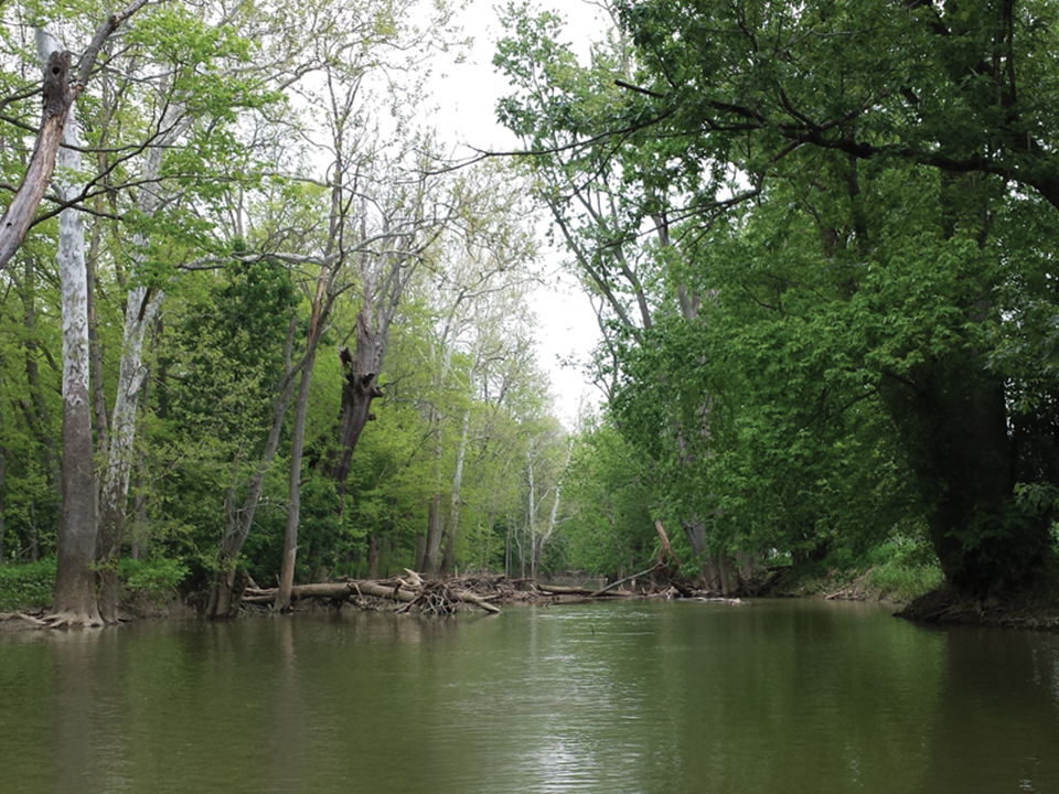
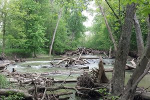
Eight logjams on the Mississinewa removed in Randolph County
The Randolph County SWCD, assisted by the UMRWP, received a logjam removal grant from the IDNR Lake and River Enhancement Fund in 2016. The total amount awarded was $100,000. The funding was used in 2016 to remove 8 of the most severe logjams along the Mississinewa River from Ridgeville, IN to Albany, IN.
The logjams had been brought to the attention of the UMRWP in 2014 during the initial public input meetings for the WMP. Landowners noted the specific impacts of logjams on recreational safety, adjacent agricultural flooding, impaired tile drainage, and exacerbation of streambank erosion. To understand the issues and raise awareness, the UMRWP conducted site visits with landowners, filmed the logjams, and partnered with Ball State University’s Immersive Learning Program to document and categorize the logjams. Select the links below to learn more about these efforts.
Log-jam Photos
– Provost Grant
– Logjam Site Visit1
– Canoe Trip 1
– Canoe Trip 2
– Logjam Videos (site visit)
Covercrops
In 2016, the UMRWP was awarded $30,000 in covercrop cost-share through the Ball Brothers Foundation. Also in 2016, the UMRWP was awarded a Clean Water Indiana grant for $123,000—portions of this grant will fund covercrop cost-share.
Covercrops were one of the most in-demand BMPs in our public input survey. Covercrops address many pollutants. They reduce erosion, reduce nutrient loss, and build soil health. Covercrops are usually planted in the fall following the harvest of field crops. Types of cover crops include radishes, wheat, and clover.
Bicentennial Nature Trust
UMRWP managers presented relevant watershed management studies and shared the process of identifying high-quality ecological areas with representatives of the Delaware County Land Conservation Fund and potential applicants to the Bicentennial Nature Trust. Theses types of long-term conservation opportunities will help protect key ecological resources adjacent to the canoeing trail and help reduce sprawl in high development areas.
Formation of the Land Conservation Fund
The partnership worked with three local Delaware County Organizations (the Community Foundation of Muncie and Delaware County, Inc., Ball Brothers Foundation, and the George and Francis Ball Foundation) to create the Land Conservation Fund. The fund was created to protect conservation and recreation areas. While the focus is on Delaware County acreage, land outside of the county but owned by Delaware County organizations is also eligible. Twelve acres of land along the Mississinewa River in Grant County was donated to the LCF to be used for expansion of the Cardinal Greenway in the future.
New Canoe Launch at McVey Memorial Forest, Randolph County
While not the result of cost-share funds, this project is mentionable because it can help to increase the public’s appreciation of the Mississinewa River.
Efforts to improve recreational opportunities along the Mississinewa River were initiated during the Upper Mississinewa River Watershed Project. Existing canoe launches were identified as well as other types of recreational opportunities along the Mississinewa River. The project manager worked with Red-tail Conservancy, a local land trust, in the construction of a canoe launch on the Mississinewa River at McVey Memorial Forest in Randolph County.
- Lakescaping
- Stormwater Swales
- Ditch Restoration
- No-till Equiptment
- Perveous Concrete
- Rainwater Catchment
- Raingarden
- Wetland
- Greenroof
- Stream Stabilization
Prairie Creek Bank Restoration Two
Prairie Creek Reservoir is of great importance to the residents of Delaware County and the surrounding area. However, it has severe bank erosion and the formation of gullies due to unmanaged runoff, which creates a direct route for sediment and other pollutants to enter the reservoir. This is a large project that will be funded by a grant from the Indiana Natural Resources Foundation, the existing Community Foundation and Ball Brothers Foundation Grants, funds from the Muncie City Parks Department, and 319 cost share funds. In addition to the bank restoration, two other rain swales were created to manage stormwater. The project was the repair of a 200 foot eroded bank that ran along one of the arms of the reservoir. The bank had greater than one to one slopes and there were areas where large amounts of soil had sloughed into the water. Coir logs were placed along the bank and vegetation was placed around the logs. The logs will help to protect the bank as the native sedges grow and develop healthy root systems. Other native plants were seeded along the bank and erosion fabric was placed to hold the hillside together while the plants develop. The potential pollutant reduction for this rain swale, assuming 90% efficiency, would be 18.9 ton/year Sediment; 21.7 lbs/year Phosphorus; and 43.5 lbs/year Nitrogen. These estimates do not include potential additional reduction by the native vegetation. This cost-share project and others at Prairie Creek will be maintained by the Muncie Parks Department and promote a healthy and clean reservoir.
Prairie Creek Stormwater Swales
Prairie Creek Reservoir is of great importance to the residents of Delaware County and the surrounding area. However, it has severe bank erosion and the formation of gullies due to unmanaged runoff, which creates a direct route for sediment and other pollutants to enter the reservoir. This is a large project that will be funded by a grant from the Indiana Natural Resources Foundation, the existing Community Foundation and Ball Brothers Foundation Grants, funds from the Muncie City Parks Department, and 319 cost share funds. In addition to the Rain Swale, a portion of the bank, and another swale was created to manage stormwater. The Prairie Creek Rain Swale is a large area that has been placed above the beach area to capture and slowly release rainwater that currently erodes away the beach every year. Approximately 125 tons of sand is washed into the reservoir yearly due to large areas such as the gravel parking lot draining towards the beach. Minor grading changes were created so that the land would slope towards the garden will force the sheet flow to enter the area. This redirection of stormwater also aided in the reduction of sediment entering the reservoir from the parking lot and gravel drive. A ditch and pipe running from the driveway to the garden will collect the water coming from that area. The Rain Swale has a variety of native sedges, grasses, and forbs that will create beautiful aesthetics adjacent to the bath house and a functional living system to manage stormwater.This cost-share project and others at Prairie Creek will be maintained by the Muncie Parks Department and promote a healthy and clean reservoir.
Muncie Parks Department Prairie Creek large swale repair and erosion control
A rapidly eroding swale was repaired using the Rosgen Method and check dams. The City of Muncie agrees to maintain the site for at least 5 years. A large swale was reengineered to the appropriate sinuosity and grade. Various check dams, both natural and manufactured, were installed to slow water and cause sediment to drop out. Live stakes, erosion fabric, and native vegetation will strengthen the new channel.
Muncie Parks Department Prairie Creek small swale repair and erosion control
A smaller swale was repaired using the Rosgen method and check dams. The City of Muncie agrees to maintain the site for at least 5 years. Erosion will be halted by erosion fabric, live stakes, and native herbaceous vegetation.
Muncie Parks Department Prairie Creek bank repair and erosion control
A rapidly eroding bank was repaired using coir logs and vegetative practices. The City of Muncie agrees to maintain the site for at least 5 years. Native vegetation, erosion fabric, coir logs, and live stakes will help strengthen the bank and the slope leading up to it.
Muncie Sanitary District 18th and Macedonia
Through the INAFSM Awards Nomination, the federal Stormwater Phase II requirements prompted the Muncie Sanitary District to establish a dedicated stormwater division. The benchmark project of the initial capital improvement program was the 18th Street and Macedonia Avenue Neighborhood Project. This project utilized effective stormwater management to transform an existing neighborhood from one that suffered for decades with standing water and deteriorated property values into a revitalization area in which the residents now take great pride. The main system comprised of negotiating with 72 individual property owners to obtain easements- without compensation- to install the stormwater collection system. The MSD used Clean Water Act Section 319 cost-share grant funds to construct the bio-swales on private property to protect water quality. These positive results will serve the residents for many years and be a model project for future improvements.
Cardinal Greenway Inc. eroded ditch repair
An eroded ditch was strengthened and repaired using the Rosgen Method and vegetative practices. The Cardinal Greenway agrees to maintain the site for at least 5 years. A survey and pebble count was conducted. Based upon that information, it was determined that the stream was a G6 in the Rosgen Classification system, with a sinuosity of >1.2, an entrenchment ratio of <1.4, a width to depth ratio of <12, and a slope of .02-.039. Using the regional curve for Ohio and the drainage area (.001 square miles), it was determined that the stream should be a B5 type stream. This type has a sinuosity of >1.2, an entrenchment ratio of 1.4-2.2, a width to depth ratio of >12, and a slope of .02-.039. Despite the slope for both classes being the same range, the stream’s slope changed from 0.03 to 0.028. Using this information, the stream was redesigned to meet these criteria. Live stakes, brush layering, coir logs, erosion fabric, and native herbaceous vegetation will strengthen the channel, reducing the extremity and effects of future erosion.
Steven O’Dell Residue & Tillage Management No-till
No-till attachments for mulch tillage on conventional corn and no-till beans were installed on one of the farmer’s tractors. The farmer entered into an agreement with the SWCD to promote this on the field for 5 years. A nutrient management plan is on file.
Paul Russell Residue & Tillage Management No-till
No-till attachments for no-till corn were installed on one of the farmer’s tractors. The farmer entered into an agreement with the SWCD to promote this on the field for 5 years. A nutrient management plan is on file.
Mark Smithson Russell Residue & Tillage Management No-till
Row cleaners, fertilizer combo for no-till beans and corn were installed on one of the farmer’s tractors. The farmer entered into an agreement with the SWCD to promote this on the field for 5 years. A nutrient management plan is on file.
Hutchinson Pervious Driveway
A 1380 square foot permeable driveway was installed at the Hutchinson’s house. The homeowners agree to maintain it according to manufacturer’s specifications for 10 years. Despite some issues with settling and cracking due to contractor error, the driveway is in good shape.
North Street Urban Garden
The North Street Urban Garden is located on the corner of East North Street and Jefferson Street. The goal of this project was to demonstrate rain capture and reuse for the neighborhood along in context of is greater mission to advocate community-based backyard garden to the community. Sheetflow is captured from a constructed shed roof structure and used for general water needs on site. Participants can grow community and local organic food in this space for their neighbors and local food kitchens. The structure is also a great space for teaching, learning, and sharing.
Prairie Creek Demonstration Rain Garden and Roof Capture
Prairie Creek Reservoir is of great importance to the residents of Delaware County and the surrounding area. However, it has severe bank erosion and the formation of gullies due to unmanaged runoff, which creates a direct route for sediment and other pollutants to enter the reservoir. This is a large project that will be funded by a grant from the Indiana Natural Resources Foundation, the existing Community Foundation and Ball Brothers Foundation Grants, funds from the Muncie City Parks Department, and 319 cost share funds. In addition to the Rain Swale, a portion of the bank, and another swale was created to manage stormwater. The Prairie Creek Rain Swale is a large area that has been placed above the beach area to capture and slowly release rainwater that currently erodes away the beach every year. Approximately 125 tons of sand is washed into the reservoir yearly due to large areas such as the gravel parking lot draining towards the beach.
John Craddock Wetland
The John M. Craddock Wetland Nature Preserve is located in the center of Muncie, Indiana, next to former industrial sites and adjacent to the White River. The Wetland Nature Preserve began as a gift of land to the City of Muncie to honor John M. Craddock’s life-long public service commitment to saving and reviving the White River and the wildlife along its corridor. The Wetland Nature Preserve is envisioned as being an inner city habitat area for flora and fauna, an outdoor educational facility and a passive respite located along the White River Greenway. A looped trail with an elevated boardwalk will guide trail users, nature enthusiasts, educators and students through emergent and scrub-shrub wetlands, mesic prairies and an upland wooded area to interpretive stations, overlooks and a nature center.
Bonham Wetland
Bonham Wetland was cleaned up and enhanced by several techniques. Invasive species were removed from the site to encourage native plant material growth. Excavation and reconstruction of the wetlands by providing channeling , erosion blankets, mulch, netting, and rip rap, and installing a new tile outlet, provided the wetland with a healthier environment to continue to be a refuge for wildlife. By utilizing these simple techniques this wetland will thrive and function to aid in the microclimate and natural diversity of this area.
Green Roof
Minnetrista has the first extensive green roof installation in East Central Indiana. It is located on the west pergola roof covering the main entry to The Minnetrista Center Building. This highly visible location allows the visitor to see up close the different varieties of sedum plants and the various wildlife that visit the roof. Scientific instruments collect data from the green roof and the opposite gravel ballast roof. The data illustrates the green roof stays cooler in the summer and warmer in the winter, while the gravel ballast roof experiences more extreme temperature changes. The green roof also slows down more storm water from leaving the roof than the gravel ballast roof. In addition, the green roof provides a habitat for butterflies, praying mantis, and birds and is aesthetically more attractive than gravel. Come see it out for yourself!www.minnetrista.net/experience/gardens/themegardens/greenroof
Walnut Creek Feasibility Study
As mentioned, in 2014-2015 the Mississinewa River WatershedProject sampled 28 sites (consisting of main stem and tributarysites). We calculated sediment loading as well as target sedimentloading for all sites. Walnut Creek had the highest exceedancesof sediment loading in the six county region during both high andlow flow events. As a tributary channel, it had the highest rateof concern expressed through our public survey (combination ofpublic meeting and comment card). Concerns specifically notedsediment erosion, logjam presence, and general maintenanceneglect. Walnut Creek is also challenged by the fact much of thedrainage area is in a glacial moraine (unconsolidated surfacematerials and bedrock) which is contributing to instability.Walnut Creek tributary is unique in that it is 15 miles long.Approximately 8 miles of the tributary is managed by a privatedrainage board in Blackford County (3 of the miles of theirjurisdiction is actually in Grant County). The remaining 7 milesis managed by the Grant County Surveyor and 5 of those milesrequire a SEA 368 Review (i.e. formal permission by the DNR toengage in any maintenance activities).We have met with the Blackford Private Drain Board for WalnutCreek, toured the project area, and did a windshield survey ofmany of the erosion sites in Grant County. We have also identifiedmany of the erosion sites in the headwaters region through aerialphotography. Land owners in the region would like guidance onhow to address erosion sites using Natural Channel Design or othermethods. The UMRWP will be applying in 2016 to the Lake andRiver Enhancement Program for an engineering feasibility studyto look at a majority of the sites and come up with some potentialsolutions.
Streambank Erosion
In addition, the UMRWP suspects that Lugar Creek and Walnut Creek’s elevated sediment levels during high flow events are driven by instream sources (based on land-use considerations, geomorphological characteristics, and professional judgement). Cost-share on 2-stage ditches & vegetated stream bank stabilization cost-share practices will be considered, but only for these two critical areas as outlined in the WMP.
DNR Awards Stream Stabilization Project Grant to Cardinal Greenway
A 2012 LARE study discovered that Deer Creek (a HUC12 Subwatershed in Grant County) ranked high for potential sediment loading when compared with other subwatersheds in the region and a significantly eroding streambank on Deer Creek was identified as a major source of sediment in this region. This reach was also threatening to erode (and therefore damage) portions of the Cardinal Greenway (CGW) Trail. In2013, the UMRWP identified this cost-share opportunity and assistedthe CGW in developing the initial engineering grant application. Theengineering grant was awarded and a design was developed to solvethe erosion problem. In 2014, the CGW subsequently applied for implementation funds and was awarded an $80,000 bank stabilization grant earlier this year! The stabilized reach will protect the CGW trail aswell as reduce sediment contribution to the subwatershed. The project is slated to be completed in 2016.