Managing a Shared Resource
Water is a public resource collectively managed by state and federal institutions and legislators representing citizens. The Indiana Department of Environmental Management (IDEM), the Indiana Department of Natural Resources (IDNR), and the US Army Corps of Engineers, are examples of institutions that execute federal and state laws and statutes governing water resources. At the local level, this mandate is executed by Soil and Water Conservation Districts (SWCDs) and other types of organizations. The SWCDs within the Mississinewa watershed combined to develop a watershed management plan in 2013. The planning process started in 2014 and the plan will be approved in 2017.
A Collaborative Effort
The UMRWP is primarily a collaboration of six Soil and Water Conservation Districts in East Central Indiana that share the Mississinewa River as a common resource. Grant, Blackford, Delaware, Jay, Randolph, and Darke County SWCDs are collaborating on efforts to steward the Mississinewa River and are working together on research, education, and implementation goals and objectives. There are also many location organizations that have been partners throughout the project. These partners include Ball State University, Taylor University, and the Delaware Metropolitan Planning Commission.
Financial Partners
There are many organizations that support the UMRWP. In fact, much of the work that we are able to accomplish is made possible through grants received from the Indiana Department of Environmental Management, Indiana Department of Natural Resources, Ball Brothers Foundation, and George and Frances Ball Foundation. Grants awarded by these institutions sustain the UMRWP’s educational and research initiatives and provide cost-share funding for BMPs.

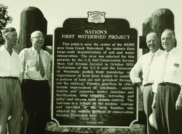
FIG 1 | SWCDs came into existence in the late 1930’s in response to the Dust Bowl and the work of Hugh Hammond Bennett. Bennett, a soil scientist and director of the Soil Erosion Service in the Department of the Interior, pushed for a local form of assistance for farmers. He is known as the father of soil and water conservation districts. Bennett is pictured above, 2nd from the left.
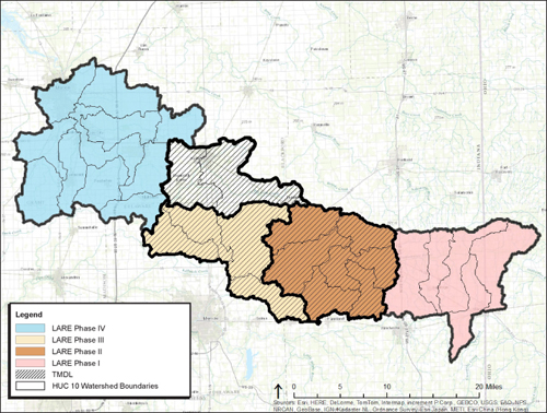
FIG 2 | There are 5 HUC 10 watersheds within the Upper Mississinewa River Watershed. HUC stands for “Hydrologic Unit Code.” The HUC system is a identification system that utilizes numerical prefixes to identify and organize watersheds. For example, all watersheds within the larger Ohio River Basin begin with the digits “05.” As the basin is subdivided again and again, more and more numbers are added to the initial prefix.


